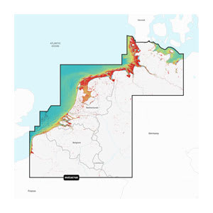
Garmin Navionics Vision+™ Benelux and Germany, West (NVEU076R) is an advanced nautical chart for Garmin chartplotters that provides detailed coverage of the North Sea coast, the Benelux countries, and the western part of Germany. The chart combines Garmin and Navionics content in a modern and clear interface with vibrant colors, making navigation easier both along the coast and on inland waterways.
With the included 1-year subscription, you get access to daily chart updates via the ActiveCaptain® app, ensuring your charts always reflect the latest changes. Auto Guidance+™ helps suggest dock-to-dock routes based on your boat settings, while detailed depth contours and depth shading provide a better overview of safe sailing routes and potential fishing areas.
The Vision+ edition adds premium features such as relief shading, high-resolution satellite imagery, aerial photos, and advanced 3D views, which provide a significantly better overview of both bottom structure and surroundings in busy harbors and narrow waterways.
Key features
-
All-in-one nautical charts for Garmin chartplotters
-
Combined coastal and inland coverage
-
1-year subscription with daily updates
-
Auto Guidance+™ dock-to-dock route guidance
-
Shading for depth and shallow-water areas
-
Up to 0.5 m depth contours
-
ActiveCaptain® community content
-
Premium Vision+ features with 3D views, relief shading, and aerial photos