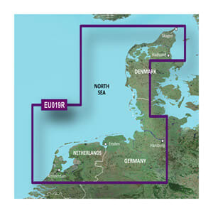
Garmin BlueChart® g3 HXEU019R is a detailed and reliable marine map on microSD™/SD™, covering the route from Aalborg to Amsterdam and providing exceptional chart coverage of coastal areas in the North Sea and adjacent waters. The map combines Garmin and Navionics® data, ensuring high clarity, precision, and detail for both navigation and fishing.
With Auto Guidance™, the map can calculate suggested routes based on your desired draft and overhead clearance, making route planning both faster and clearer. Depth range shading allows for visually highlighting up to 10 target depths, while 30 cm contour lines provide a far more precise representation of bottom structure – ideal for both safe sailing and effective fishing.
BlueChart g3 also supports downloading NOAA raster charts via the ActiveCaptain® app (where available), which provides paper-chart-like views with clearly marked points of interest. A solid choice for sailors who want professional cartography and confident navigation on longer coastal stretches.
Key features
-
Marine charts for Garmin chartplotters
-
Coverage from Aalborg to Amsterdam
-
Integrated Garmin and Navionics® map data
-
Auto Guidance™ route planning based on draft and clearance
-
Shading of up to 10 depth ranges
-
30 cm contour lines for improved bottom detail
-
Support for ActiveCaptain® features