
Description
Outstanding map coverage of coastal areas
- Provides the industry's best coverage, clarity and detail with up-to-date coastal charts integrating Garmin and Navionics® data
- Auto Guidance 1 technology calculates a route with your desired depth and clearance and suggests a route for you to follow
- With depth range shading for up to 10 depth ranges, you can quickly see the target depth
- 30 cm depth curves provide a more accurate representation of bottom structure on the improved fishing chart
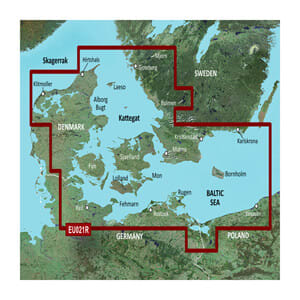
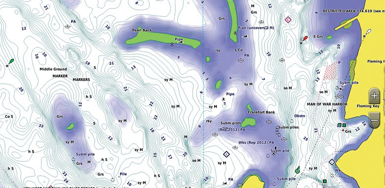
BlueChart g3 coastal maps provide the industry's best coverage, clarity and detail with integrated Garmin and Navionics data. Also includes Auto Guidance 1 technology that uses your desired depth and clearance to calculate routes and suggest a route for you to follow — overlaid on your chart. NOAA raster cartography is also available as a free download through the ActiveCaptain app. It gives your chartplotter paper-map-like views of NOAA surveyed areas, with individual points of interest labeled with corresponding latitude and longitude information. Global coverage is available by region as accessory maps or via download. Each region sold separately.
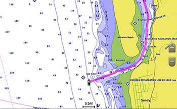
Auto Guidance technology
Auto Guidance function 1 calculates a suggested route using your desired depth and clearance.
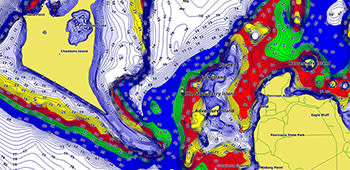
Shading in depth range
To provide a clear view of shallow water that should be avoided, you can shade custom minimum depths.
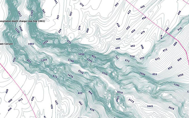
Detailed depth curves
BlueChart g3 charts feature depth contours at 12-inch intervals, providing a more accurate representation of bottom structure on the enhanced fishing chart.
Shallow water shading
To provide a clear view of shallow water that should be avoided, you can shade custom minimum depths.
Kontakformular
Ofte købt sammen med