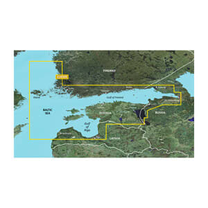
Garmin BlueChart® g3 HXEU050R is a detailed digital marine map on microSD™/SD™ that covers the Gulf of Finland and the Gulf of Riga with high precision. The map combines Garmin and Navionics® data to provide a clear, concise, and up-to-date view of coastal areas, ports, shipping routes, and depth contours.
With Auto Guidance™ (for route planning), you can calculate suggested routes based on your desired depth and clearance, while 30 cm depth contours provide a more accurate representation of bottom structure – ideal for both safe navigation and fishing. Depth and shallow water shading makes it easy to quickly identify critical zones to avoid.
BlueChart g3 also supports NOAA raster charts as a free download via the ActiveCaptain® app, providing paper-chart-like views in supported areas. The map is suitable for both coastal sailing and longer passages in the Baltic Sea region.
Key features
-
Digital marine map for Garmin chartplotters
-
Coverage of the Gulf of Finland and Gulf of Riga
-
Integrated Garmin and Navionics® map data
-
Auto Guidance™ route planning¹
-
Depth and shallow water shading
-
30 cm depth contours for higher accuracy
-
Supports ActiveCaptain® and NOAA raster charts