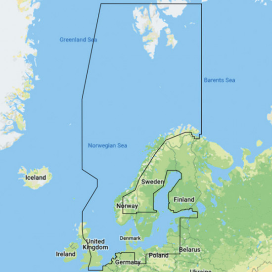
This C-MAP Discover Y050 electronic chart is for Scandinavia and is supplied on a microSD/SD card for compatible Lowrance, Simrad, and B&G plotters. The chart is sold only in connection with the purchase of a compatible chartplotter.
The chart covers coastal areas in Denmark, Sweden, Norway, and Finland, as well as major lakes and inland waterways. It contains detailed vector charts with depth contours, coastlines, harbors, navigational aids, and lighthouses.
Custom Depth Shading makes it possible to color-code depth areas according to your own intervals, while Easy Routing automatically calculates a route between two points based on depth and clearance from the chart data. Tide stations, current arrows, marinas, anchorages, ramps, and service locations are included where data is available.
Key features
Electronic chart for Scandinavia on a microSD/SD card
Covers Denmark, Sweden, Norway, and Finland, as well as major lakes and inland waterways
Detailed vector charts with depth contours, harbors, navigational aids, and lighthouses
Custom Depth Shading for displaying selected depth intervals
Easy Routing, tide stations, current arrows, and points of interest where data is available