


Description
Garmin GPSMAP® 8422 MFD chartplotter
SERIOUS FISHERMEN, CRUISERS, SAILORS AND RACERS NEED PROFESSIONAL EQUIPMENT
The combined chartplotter/sounder package is user-friendly, easy to install and provides MFD performance in a handy combo package.
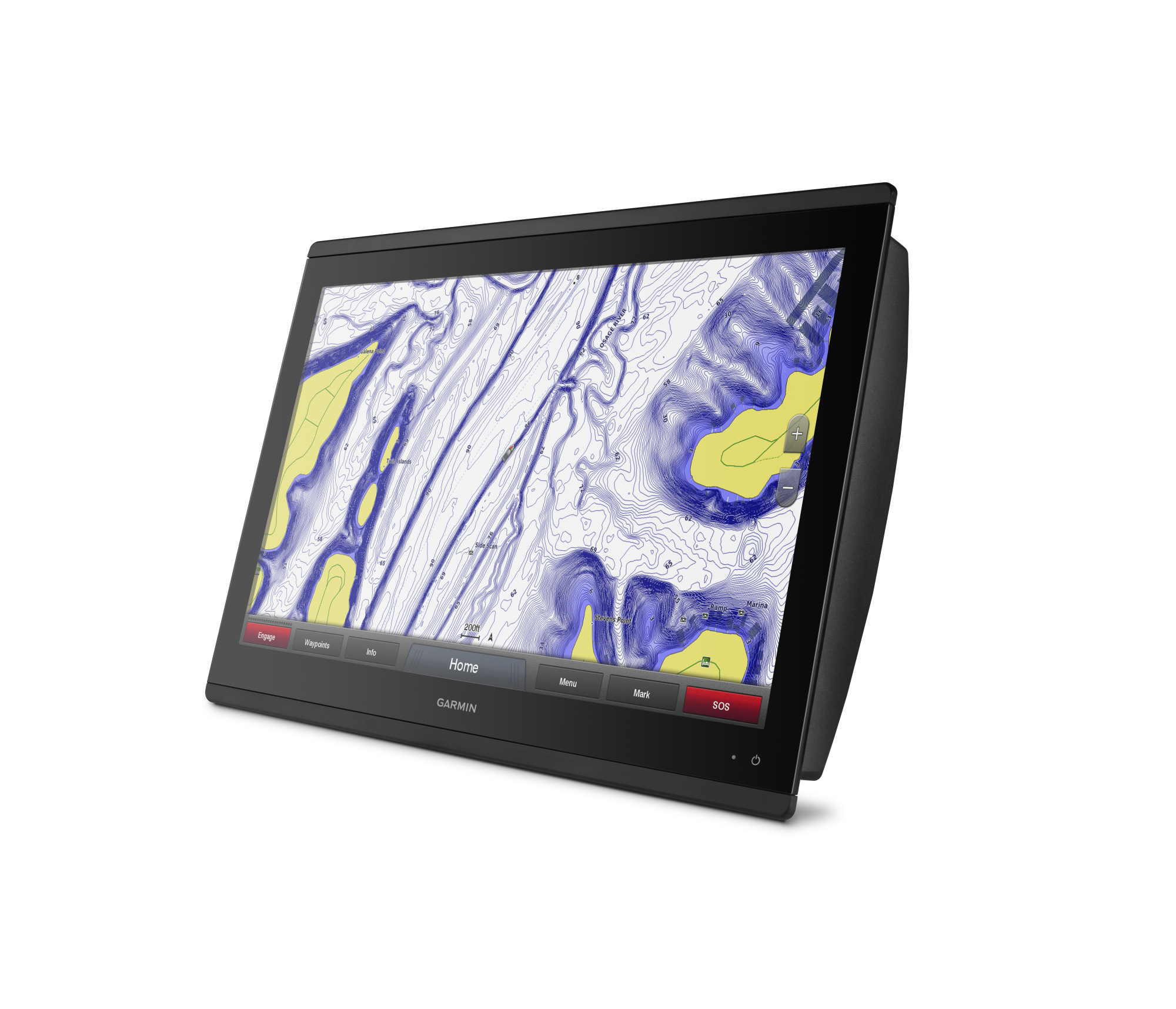
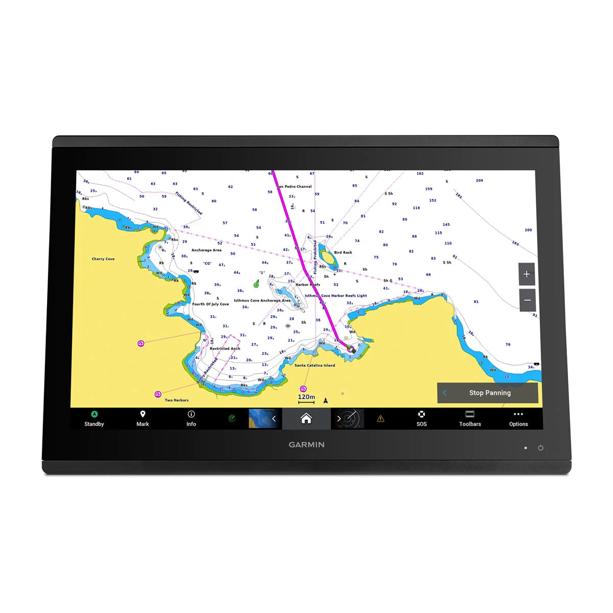
Get wider viewing angles and superior image clarity on the touchscreen with a Full HD In-Plane Switching (IPS) display.
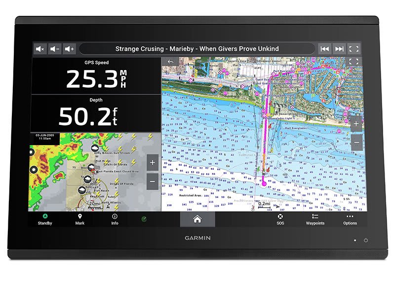
Navigate confidently with built-in Garmin Navionics+™ inland and coastal mapping 1 .
You can easily build your marine system using the best network connection.
See below and around your boat with built-in sonar capabilities (transducers sold separately)
From ANT ® technology to Wi-Fi ® networks, there are countless ways to connect to your system.
With SmartMode™ station control buttons, everything is designed to give you quick, one-touch access to the information you need.

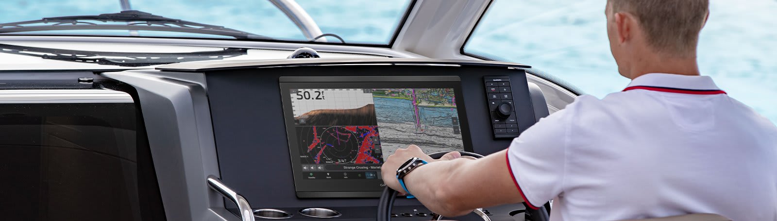
Made for your helm station.
HD IPS TOUCHSCREEN
This display, available in 10″, 12″ and 16″, offers wider viewing angles, premium image clarity and sunlight readability, even with polarized sunglasses.
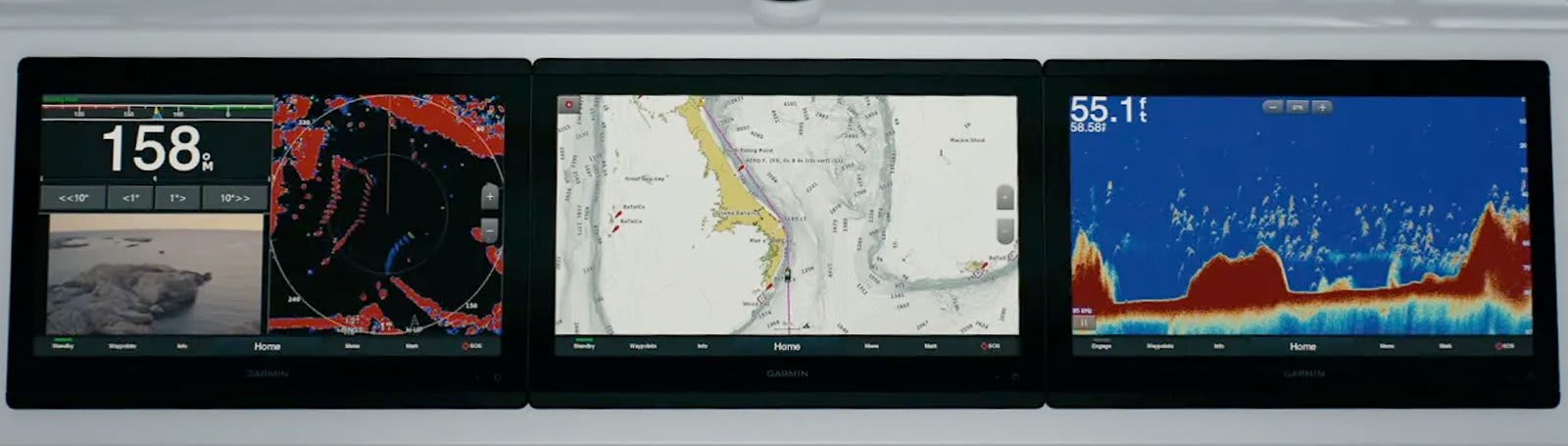
SIMPLE, ATTRACTIVE MOUNTING OPTIONS
You can install multiple screens, either surface-mounted side by side, which creates an elegant glass-look helm station, or flush-mounted – creating a breathtaking helm station.
GRID™ 20 REMOTE CONTROL
The optional, easy-to-use GRID 20 remote input device provides intuitive remote access and control of your entire Garmin marine system.
See the world below you.
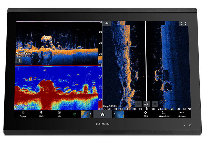
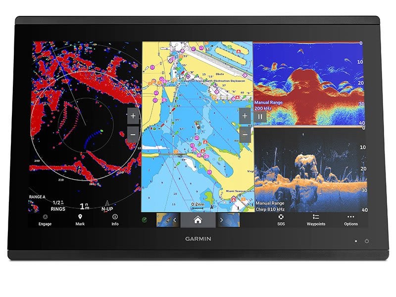
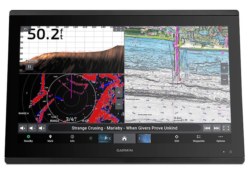
SUPPORT FOR TRADITIONAL SONAR AND SCANNING SONAR
Get built-in support for 1 kW dual-channel CHIRP traditional sonar for superior target separation and ClearVü and SideVü scanning sonar to see up to 1,000 feet below and around your boat at 260 kHz (requires transducer, sold separately). Built-in sonar compatibility available on xsv models only.
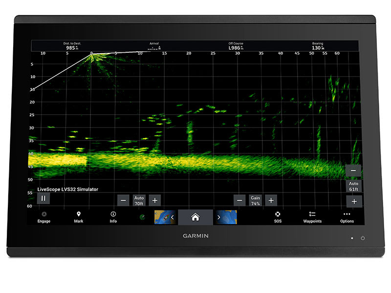
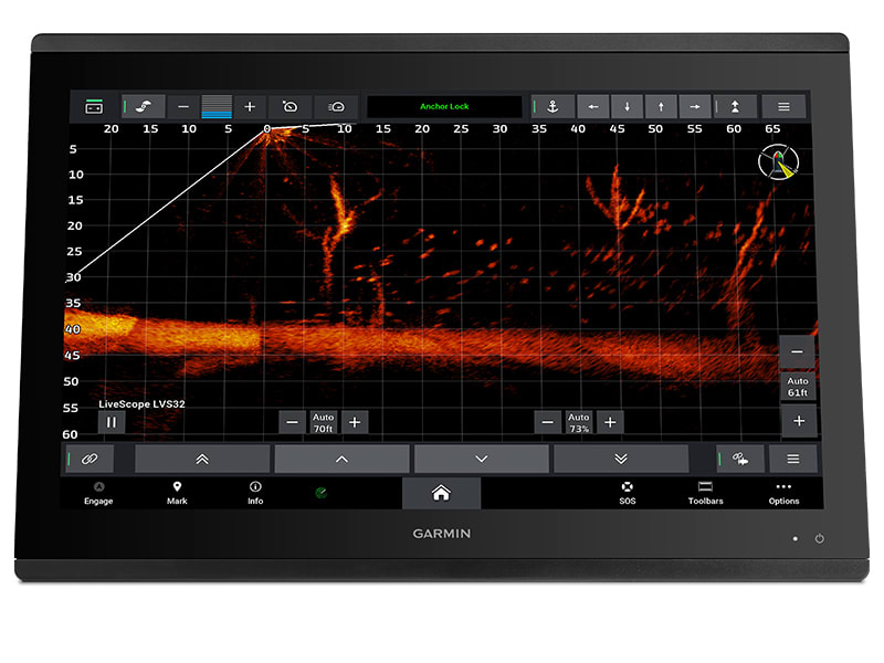
PANOPTIX™ SONAR SUPPORT
Pair your chartplotter with Panoptix or Panoptix LiveScope™ easy-to-read sonar (transducer sold separately) to see all around your boat in real time.
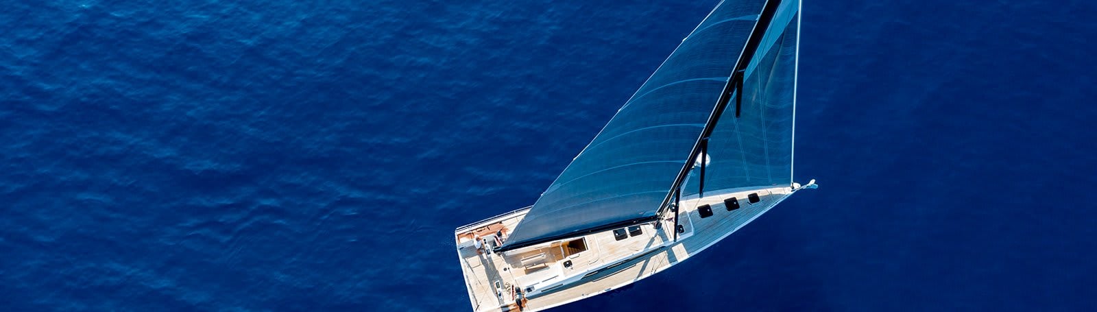
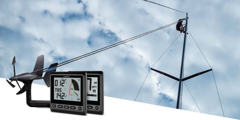
Sail and navigate with ease
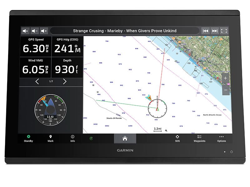
GARMIN SAILASSIST™ SAILING FEATURES
View laylines, racing start line guidance, enhanced wind rose, heading and course over ground lines, true wind data fields and sliders for tide/current/time, wind direction, heading and drift, wind speed, etc.
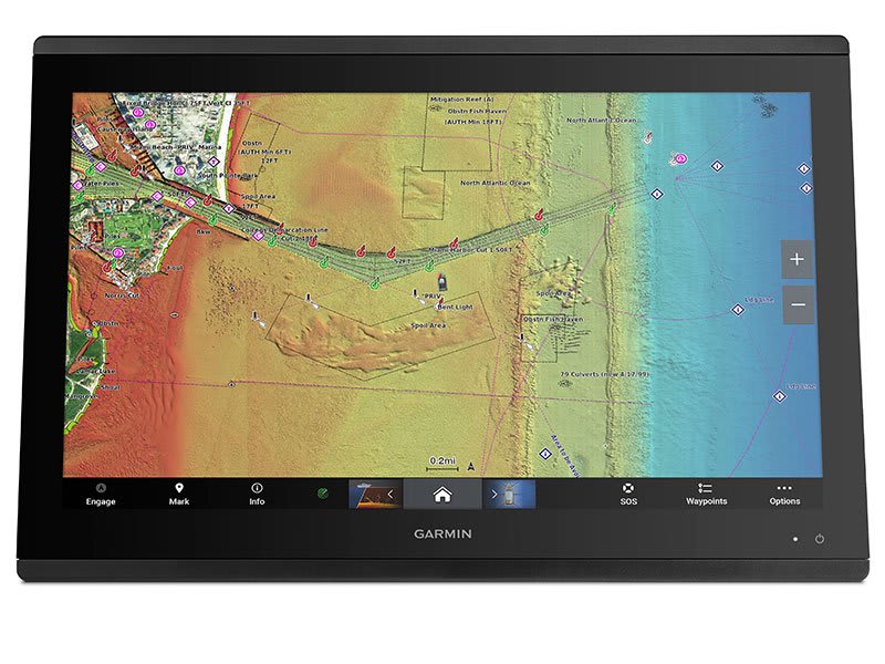
CHART
Give your chartplotter a fresh new look and feel with optional Garmin Navionics+™ or premium Garmin Navionics Vision™ cartography with integrated coastal/inland content, access to daily updates, Auto Guidance+™ technology 2 and more.
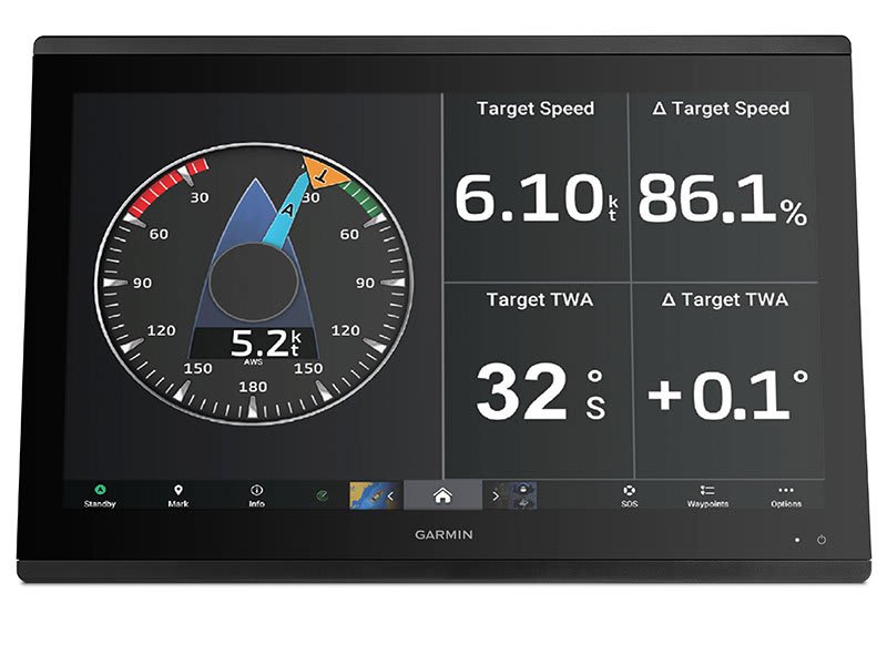
POLAR COORDINATE SYSTEMS FOR SAILING VESSEL NAVIGATION
Use the polar coordinate system to see important data, including how fast you should sail at a specific wind angle and speed — so you know if you need to adjust your sail trim.
Connect to everything on your boat
GARMIN MARINE NETWORK
If you have multiple Garmin devices on your boat, you can share information – such as charts, user data, radar and IP cameras – between them.
NMEA 2000® AND NMEA 0183 NETWORKS
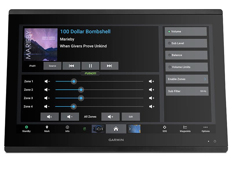
Connect to autopilots, digital switching, weather, your FUSION-Link™ audio system, media, VHF, AIS and more from one screen.
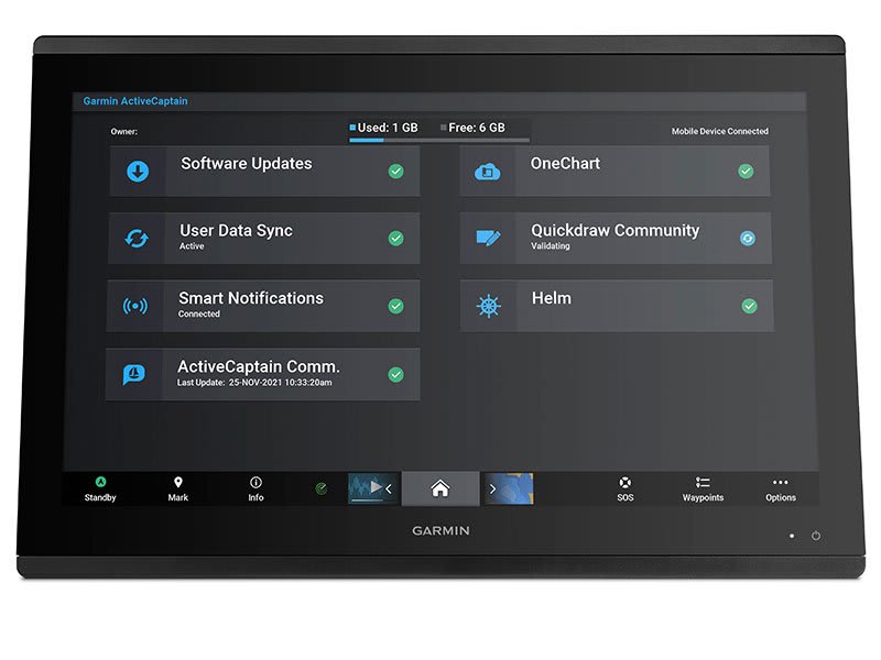
ACTIVECAPTAIN® APP
Built-in Wi- Fi® connectivity pairs with the free all-in-one mobile app to access OneChart™ functionality, smart notifications 3 , software updates, Helm, Garmin Quickdraw™ Community data and more.
INTEGRATED BLUETOOTH ® AND ANT TECHNOLOGIES
Connect to some of your favorite devices, such as quatix ® marine watches, gWind™ Wireless 2 transducers, GNX™ Wind marine instruments, and wireless remote controls.
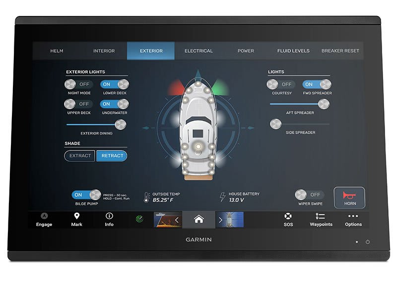
ONEHELM™
This feature brings together all actions and functions from third-party devices, such as EmpirBus™ digital switching, on one screen.
SMARTMODE STATION CONTROL BUTTONS
Get quick access to the information needed to ease stressful situations like docking. You can incorporate networked sonar, radar, cameras, media and more.
POWER-POLE ® LOW WATER ANCHOR
By networking select Garmin chartplotters with a Force® electric motor and your compatible Power-Pole shallow water anchor system, you can access advanced boating features 6 from your chartplotter, including auto anchoring, smart anchor push, auto stow, anchor drag detection and anchoring at the end of the Auto Guidance 2 route. Spend more time fishing and less time positioning.
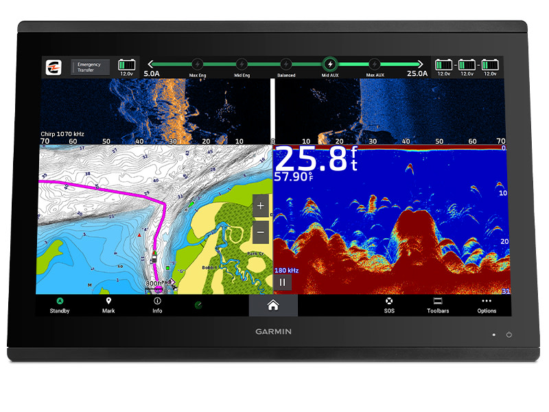
CHARGE INTEGRATION FROM POWER POLE
Your CHARGE Marine Power Manager from Power-Pole integrates with compatible Garmin chartplotters to help your battery last longer and last longer in the water. You can charge batteries on the go, monitor power usage, choose where to allocate power, control emergency starting, and even transfer power between battery banks - all from your chartplotter screen.
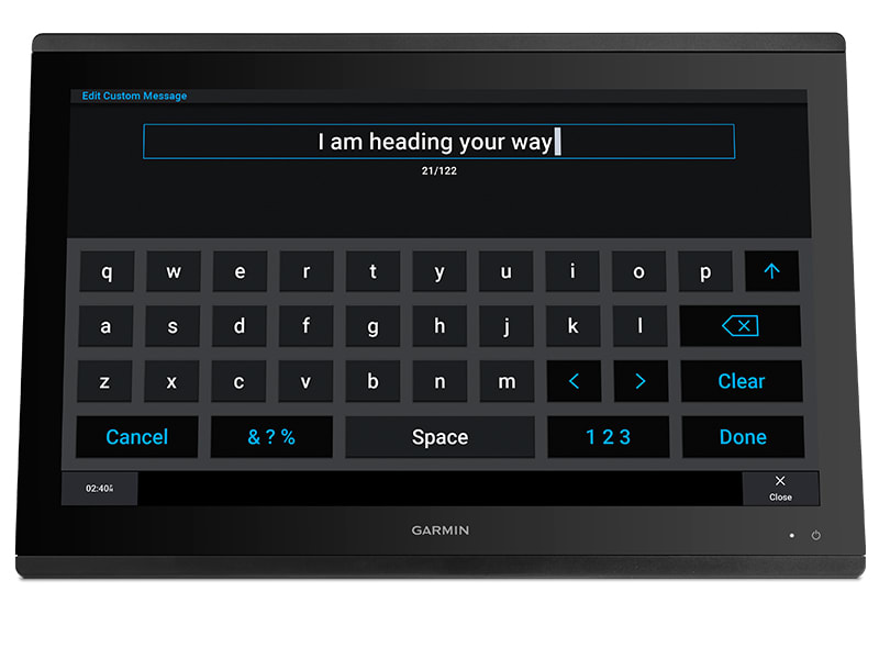
SEND INREACH ® DEVICE MESSAGES
Pair your inReach 5 satellite communicator with your chartplotter and enter custom messages using the MFD's on-screen keyboard. Access your contact list or enter an email, inReach address, or phone number. You can also group messages by conversation for a text-like experience.

Kontakformular
Ofte købt sammen med