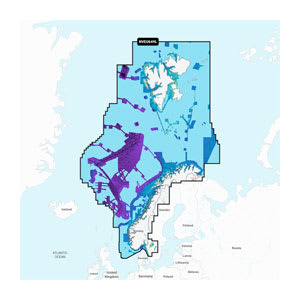
Garmin Navionics Vision+™ Norway (NVEU649L) is a comprehensive nautical chart for Garmin chartplotters, providing detailed and modern cartography of the entire Norwegian coast as well as selected inland areas in Norway and Sweden. The map combines Garmin and Navionics content in a streamlined user interface with vivid colors, making navigation in fjords, archipelagos, and open waters both clearer and safer.
With the included 1-year subscription, you get access to daily chart updates via the ActiveCaptain® app, ensuring changes in markers, depths, and harbor conditions are continuously incorporated. Auto Guidance+™ provides suggested dock-to-dock routes based on your vessel settings and helps you navigate safely through complex coastal stretches, fjords, and inlets. Depth contours, shallow water markers, and depth shading provide extra peace of mind when sailing in challenging waters.
The Vision+ version also contains premium features such as relief shading, high-resolution satellite imagery, aerial photography, as well as 3D FishEye and MarinerEye views, which provide a significantly improved overview of bottom structure, coastlines, harbors, and navigational conditions – both above and below the water's surface.
Key features
-
Nautical charts for Garmin chartplotters
-
Detailed coverage of the entire Norwegian coast
-
1-year subscription with daily updates
-
Auto Guidance+™ dock-to-dock route guidance
-
Shading of depth and shallow water areas
-
Up to 0.5 m depth contours
-
ActiveCaptain® community content
-
Premium Vision+ features with 3D view, relief shading, and aerial photos