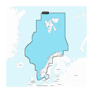
Garmin Navionics+™ NSEU649L – Norway nautical chart (microSD™/SD™ with 1-year subscription) provides you with advanced and detailed mapping for your Garmin chartplotter, covering Norwegian coastal areas, lakes, and inland waterways. The chart combines Garmin and Navionics® data, presenting them in a modern, user-friendly view with vibrant colors and improved clarity.
With access to daily updates via the ActiveCaptain® app, you always have the latest chart data, while Auto Guidance+™ helps plan suggested dock-to-dock routes through harbors, channels, and coastal waters. The chart is designed for both navigation and fishing, featuring detailed depth contours, seabed imagery, and the ability to customize the view as needed.
A complete all-in-one charting solution for Garmin chartplotters, providing both precise navigation and a powerful tool for planning voyages and fishing trips.
Key features
Detailed map coverage of Norway's coasts, lakes, and inland areas
Combined Garmin and Navionics cartography in one solution
Daily chart updates via the ActiveCaptain app
Auto Guidance+™ with suggested dock-to-dock routes
Depth contours down to 0.5 m for improved navigation and fishing
Depth range shading and shallow water shading
Seabed imagery for anchoring and fishing
Community data with marinas, anchorages, and hazards
Optional upgrade with Garmin Navionics Vision+ features