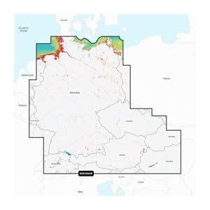
Garmin Navionics Vision+™ Germany, Lakes and Rivers (NVEU060R) is a comprehensive inland lake map for Garmin chartplotters, designed for navigation on Germany's rivers, canals, and lakes as well as adjacent international waterways. The map combines detailed Garmin and Navionics cartography in a modern and easy-to-read design with vibrant colors that make navigation on inland waterways both safer and clearer.
With the included 1-year subscription, you get access to daily chart updates via the ActiveCaptain® app, ensuring that changes in depths, markers, and harbors are always up to date. Auto Guidance+™ offers suggested dock-to-dock routes based on your vessel settings, while detailed depth contours, shallow water shading, and depth shading help you plan safe routes through rivers, canals, and lake systems.
The Vision+ edition also includes premium features such as relief shading, high-resolution satellite imagery, aerial photos, and advanced 3D views, providing a significantly better overview of bottom structure, bridges, locks, marinas, and harbors along the inland waterways.
Key features
-
Inland lake map for Garmin chartplotters
-
Detailed coverage of rivers, canals, and lakes in Germany
-
1-year subscription with daily updates
-
Auto Guidance+™ dock-to-dock routing
-
Depth and shallow water area shading
-
Up to 0.5 m depth contours
-
ActiveCaptain® community content
-
Premium Vision+ features with 3D view, relief shading, and aerial photos