
Description
First class card
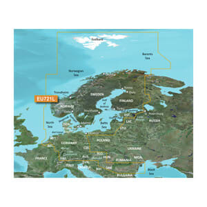
Provides excellent coverage, clarity and detail with coastal charts that integrate Garmin and Navionics® data
Auto Guidance1 quickly calculates a suggested route using the desired depth and clearance and includes a suggested path
Certain areas feature relief shading (downloadable through the ActiveCaptain app), which combines color and shading to give you an easily readable, clearer view of bottom structure.
Includes depth range shading for up to 10 depth ranges so you can quickly see your target depth
Depth curves up to 30 cm (1 ft) provide a more accurate representation of bottom structure on the enhanced fishing chart
The Shading feature lets you highlight areas with shallower water than a user-defined depth
Experience unmatched coverage and stunning detail when you're on the water. BlueChart® g3 Vision charts provide the industry's best coverage, clarity and detail with integrated Garmin and Navionics content.
Autoguide
Whether you're fishing or boating, choose a location and get a route that shows the general route and nearby obstacles at a safe depth1.
Autoguide
Shadow relief
This unique shading feature, available for the UK, Ireland, Belgium, France, Germany, the Netherlands and Norway, combines colour and shading to give you an easy-to-read view of the bottom profile, making it easy to find artificial reefs, underwater reefs and more. Relief shading can be downloaded from the ActiveCaptain® app.
Shadow relief
Shading of depth areas
This feature allows you to shade up to ten depth intervals for maximum overview of depth curves for your specific use.
Shading of depth areas
Shallow water shading
Get clear marking of shallow water to avoid, with shading of all areas below a user-defined depth.
Shallow water shading
Detailed depth curves
BlueChart g3 charts feature depth contours every 30 cm (1 ft) for a more detailed representation of bottom structure on the enhanced fishing chart, as well as improved detail in shallow water areas, channels, and harbors.
Detailed depth curves
High-resolution satellite images
High-resolution satellite imagery overlaid on the navigation chart gives you a realistic view of your surroundings. It's our most realistic map view in a chartplotter – ideal for getting an overview of foreign marinas and ports.
High-resolution satellite images
FishEye view
This underwater perspective shows a 3D rendering of the bottom and contours seen from below the waterline. Interface with sonar data for a customized view.
FishEye view
MarinerEye view
This view provides a 3D image of the immediate area, both above and below sea level.
MarinerEye view
Aerial photos
Crystal clear aerial photos show many marinas, ports, and marinas in high detail, and it is ideal when entering foreign ports.
Aerial photos
1Auto Guidance is for planning purposes only and is not a substitute for safe navigation.
Categories
Ofte købt sammen med